Run on Dirt in Winter on the Tahoe Pyramid Trail
When completed, the Tahoe Pyramid Trail will follow the entire length of the Truckee River from its start at Lake Tahoe, to its terminus at Pyramid Lake. Sections of the trail are still under construction but when everything is finished, it will run a total of 114 miles with over 2000 feet of elevation change. While it begins at 6200 feet at Lake Tahoe, portions of the trail at lower elevation stay snow-free, making it an ideal choice for winter running.
Cyclists, runners, and hikers alike will enjoy spending time on this trail. It’s open to bike and foot travel and presents a mix of trail surfaces and environments – at times a single track, dirt road, gravel, mud, etc. The trail is broken down into sections, making it accessible for shorter distances.

In winter, the lower elevation Hirschdale to Verdi section is usually snow-free, offering a nearby escape from the snow-covered trails in Truckee. It’s a short 20-minute drive to this section of the trail. There are several parking areas to choose from, giving you a variety of starting locations for a one-way run or bike ride with a car shuttle or an out and back trip.

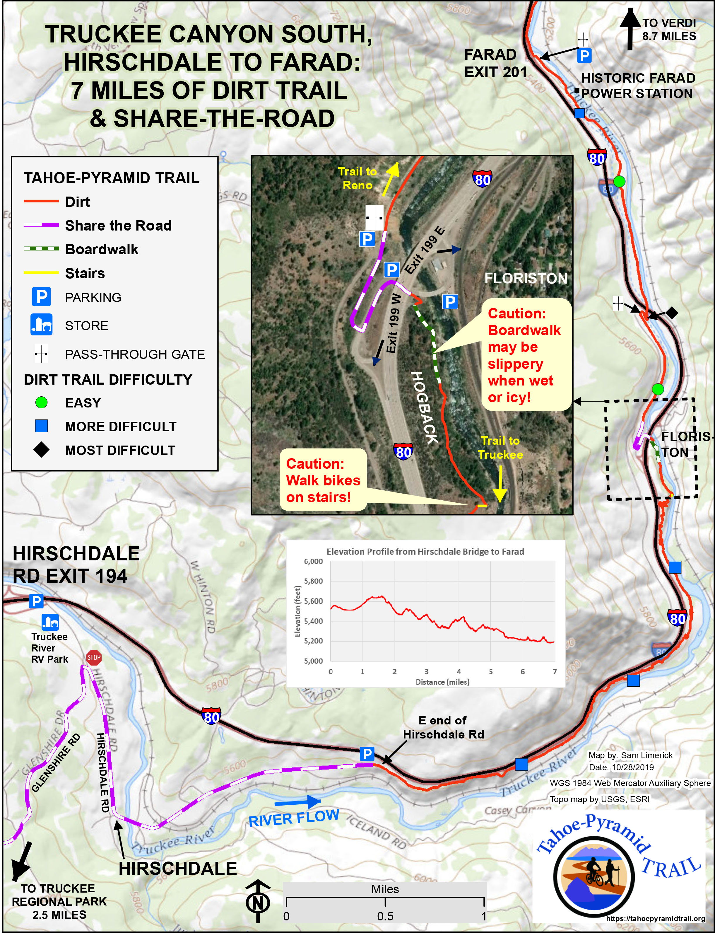
Hirschdale to Fared
Distance – 7 miles one way
Difficulty – moderate
Map and Directions – Click here to view a detailed map of the Hirschdale to Fared section.

Fared to Verdi
Distance – 8.6 miles one way
Difficulty – easy to moderate
Map and Directions – Click here to view a detailed map of the Fared to Verdi section.
To learn more about the Hirschdale to Verdi section of the Tahoe Pyramid Trail, as well as GPX file downloads of the route, click here.
Share this
Popular posts


Leave a comment