Gorgeous Day Hike from Lukens Lake to Tenaya Lake in Tuolomne
This post comes from Rachel McCullough, an avid hiker, mountain biker, rock climber, yogi, skier and photographer living in Truckee, CA. Follow @rachelmcphotos on Instagram for stunning images of beautiful Sierra scenery. When Rachel isn’t enjoying the outdoors, she’s teaching skiing at Northstar California or building and marketing websites for her clients at McCullough Web Services.

Who: Theresa, Tom, Garrett, Rachel
What: 26 Mile Day Hike
Where: Ten Lakes area, Tuolumne high country, Yosemite National Park
When: A Saturday in August, 2014
Gear: Altra Lone Peak Trail Running Shoes, Nemo Losi 3 Person Tent, PowerPot Charging Package, Sawyer Point Squeeze Filter
All photos by Rachel McCullough unless captioned otherwise.
One day I decided to walk 55 miles. In a day. Not just any 55 miles, but the entire High Sierra Camp loop in Yosemite National Park, with over 8,000 feet in elevation gain and loss. I hadn’t hiked more than 15 miles in a day, but that didn’t seem to matter. So, I did it. And I dragged along my then boyfriend, now husband. Maybe for company, maybe to see if he was crazy enough, maybe to see if he could keep up. And that was my first taste of the yet to be named sport of hiking a lot in one day.
I’ve kept it under 45 miles since then, but still get all sorts of looks and questions on these long hikes. “Wait, where are your big backpacks?” “You are going where?” “You mean (put any much closer destination here)?” All you need is a light pack, trail running shoes, and enough water to make it to the next stop. It’s amazing how much you can see and how far you can get without a lot weight, wilderness permits, or advanced planning. I get my gear at Tahoe Mountain Sports. But more on the advanced planning later.
So, that leads me to my most recent hike in Tuolumne, a follow-up to my “Let’s walk from Wawona to the Valley hike” this spring. This one came in at about a marathon distance – 26.6 miles says the map. We started at the Lukens Lake Trailhead and passed through Ten Lakes before arriving at our destination, the Murphy Creek Trailhead. We added a short detour to Grant Lake because 26 miles sounded better than 24 miles.
The crew. I’ve had many adventures with this group: Garrett, my husband, and Tom and Theresa, our good friends who live in Yosemite. As usual, we set our starting time, slept in a bit later than we should have, and then slowly got ready. A group of mostly night owls should not rise before 6 a.m., but we can certainly try! We hit the trail late, around 7:30 a.m., which meant that if we wanted to finish by dark, there would be no dilly-dallying.

But, we forgot that we were in a hurry, when just a half-mile in, we arrived at Lukens Lake. It was perfectly still, except for the layer of fog dancing along the surface and then rising before disappearing into the warming morning air. John Muir once said about hiking: “I don’t like either the word or the thing. People ought to saunter in the mountains – not hike!” So, we stopped, took our time, then we sauntered along.

The next gem we found was a slightly nibbled red fir cone, which revealed the brilliant red inside. Two things were amazing about this: none of us had ever seen this before and red firs are apparently named for the color of their bark, not the inside of their cone!

As the morning passed, we approached Ten Lakes, which we had hiked to together a few years previous. This time, we took a two-mile detour to Grant Lake. The one-mile descent felt the longest of the entire hike. None of us had looked at the map to see whether it was up or downhill and there was some mention early in the hike of our detour being flat. This is what happens when finalizing your route by headlamp the night before. I figured that when we actually arrived, the lake would be dry (I had already hiked nine miles to Twin Lakes on the Tahoe Rim Trail to find no water), but I was wrong. It was people-free and stunning.

And the hike back up, which I thought must be twice as long as the map said, was fast, and we were back on the trail, heading towards the panoramic views of our next high point before our descent to Ten Lakes. We still sauntered even though we’d all seen this before. We pondered whether the lakes were numbered and which one had the honor of being number one. We tried to figure out what this very long day hike adventure we were on should be called, but couldn’t come to an agreement.


Being close to our halfway point, we stopped at Ten Lakes to filter water. Our Steripen had run out of batteries (lesson learned – you need Lithium ones), so we had one hiking water filter for the four of us. This filter is so light, you might as well carry two if you are in a hurry. Some of us were more skilled than others at getting the pouch to fill up, making this our longest stop. We met a couple of day hikers who, although mystified about our journey, were happy to snap our photo before we were off.

Our second big climb of the day took us out of the Ten Lakes Basin and dropped us into the canyon of the South Fork of Cathedral Creek with stunning, granite-filled views to the north and east. Most people probably have never even heard of this place, but it definitely ranks up there as one of the best views in Yosemite. And, we had it all to ourselves! Our tired eyes saw a golf course at the bottom of the canyon, and joking that there might be a clubhouse, we headed down the rock-strewn switchbacks interspersed with twisted juniper trees that provided some nice shade on an otherwise sun-baked and exposed slope.

The views didn’t end there. As we climbed back out, we were treated to more steep granite walls, this time with the hint of evening in the air as the sun sunk lower in the sky and the shadows deepened.

This was our last climb, which would bring our total up to over 6,000 feet of climbing over the 26 miles. Near the end of the climb, we came across a bear’s paradise. A little oasis, high up in the mountains, still full of water even though all the nearby streams were dry. We saw the bear’s prints and Tom gave his legs a break (but his arms got a workout!)

Then it was time to beat the sun back down to the trailhead. I’ll have to admit, we had stopped sauntering at this point and for some reason, just had to get back in the light. All of us have logged many miles in the dark. In fact, some of my best hiking memories were in the dark, but that evening, we picked up the pace and headed for the road on the forested Murphy Creek trail. We took just one last stop before the trailhead to find these day-glow yellow Sulphur Shelf fungi creeping up a conifer. Although I often think the big vistas are where it’s at, things like this remind me of all the gems hidden in the forest.

Mission accomplished! We completed the adventure while it was still light out and as we headed back to our campsite, I wondered if I would be sore the next day. Incredibly, my new Zero Drop Running Shoes didn’t allow for that, but a car ride back to Tahoe was in order, with a few short detours and a rock-skipping session at Tioga Lake.
There was only one thing we didn’t accomplish: Naming this kind of adventure. A marathon day with no name. I guess there will be plenty more hours on the next hike.

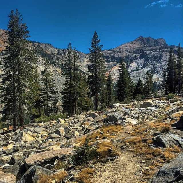
Here are a few more photos from the rest of our Tuolumne adventure:


Please tell me in the comments what you think this type of adventure should be called: long-distance day hiking, ultra day hiking, plain old craziness, a John Muir saunter…?
Share this
Popular posts


Leave a comment