Mud Lake: The Journey Was Better than the Destination

This post comes from Rachel McCullough, an avid hiker, mountain biker, rock climber, yogi, skier and photographer living in Truckee, CA. Follow @rachelmcphotos on Instagram for stunning images of beautiful Sierra scenery. When Rachel isn’t enjoying her free time in the outdoors, she’s teaching skiing at Northstar California or building and marketing websites for her clients at McCullough Web Services.
Who: Rachel and Garrett McCullough
What: Hiking
Where: Tahoe Rim Trail – Brockway to Mt. Rose segment
When: June 2015
Only I could think up a hike where the destination was a muddy lake that would require 23 miles of hiking. And only my husband, Garrett, would think this was a good enough idea to tag along cheerfully.
So, it really had to be all about the journey; as is my goal of day hiking the entire Tahoe Rim Trail.
The Tahoe Rim Trail has presented a challenge to Garrett and me. Not because of the hiking itself, which seems to be the easy part, but in the logistics. Being a one car family, and the fact that no one has shown too much interest in 20-30 mile day hikes with us, shuttling is a bit difficult.
The Tahoe City to Brockway section took 4 modes of transportation to complete. We drove to Brockway, rode our bikes down to the bus stop in Kings Beach, took the bus to the trailhead in Tahoe City, walked the trail to the car, then drove back to pick up the bikes in Kings Beach! And while that seemed somewhat reasonable (except to anyone we explained this convoluted plan to, planning for the others hasn’t been as easy).
We completed the Brockway to Mt. Rose section a bit differently. Last year, we started at Mt. Rose, with our goal destination being Mud Lake, about halfway between the Brockway and Mt. Rose trailheads. We didn’t quite make it all the way, but we came close. So this particular weekend, we headed out from Brockway to tick off the remaining piece. That made our destination somewhere past Mud Lake.
So as my wise friend, Gretchen, pointed out when I hatched this plan of day-hiking from either trailhead to the middle – when we are done we’ll have hiked nearly the whole trail twice. So here’s to hiking the Tahoe Rim Trail twice, once in each direction!
Our adventure on the Brockway to Mt. Rose section began by loading up with 5 liters of water (each!) and setting out at the not-so-early hour of 8:30 from Brockway towards Martis Peak. Have I mentioned before we are not morning people?! Almost immediately, we were both drenched in sweat. Garrett asked me if the trail seemed harder than usual (we’d done the first part many times). Maybe it was all the water we were carrying to prevent getting overwhelmed by the heat.
This did not seem like the way to start 23 miles. I think the problem was that it was actually warm out. Summer temps plus some morning humidity wasn’t something we’d gotten used to yet.
The lake came in and out of view on our right side for the first several miles, until it eventually opened up so that all you could see was blue. The blue of the sky, the blue of the lake; what a gorgeous color.

The trail meandered and switchbacked through the forest, before eventually leading to more open and treeless terrain. We stopped for a break at the last bit of shade, not so much because we were tired, but more because we were scared of the sun-baked terrain in front of us! We might wilt! Luckily as we climbed higher, it cooled down and we got a nice afternoon breeze. Being at over 9,000 feet definitely helps.

We joked along the way about our goal of Mud Lake. We wondered if there was even going to be water. Garrett still hasn’t let me live it down that I built up our hike to Twin Lakes on the Mt. Rose to Spooner section, only to find no water upon reaching the first lake. He claimed I was leading him on again. I started to wonder myself since we had decided on the route late the previous night and hadn’t asked around.
We agreed this was the best section of the trail so far. Views like on the Flume Trail, but without the bikes or crowds.
On the way to Mud Lake, there were a couple of tempting diversions. One was a rock outcropping with an easy climb and a lake view. Garrett reminded me that all diversions should be done on the way back. That way you know if you have enough energy to make it to the end. And he’s right! It’s easy to be excited 7 or 8 miles in! We did end up stopping for the short rock climb, but held off on Rifle Peak to see how we felt on the way back.
Then, I spent the next few miles tripping over my own feet as I forgot about the trail and stared at the lake. The most gorgeous part of the hike definitely went by the quickest.
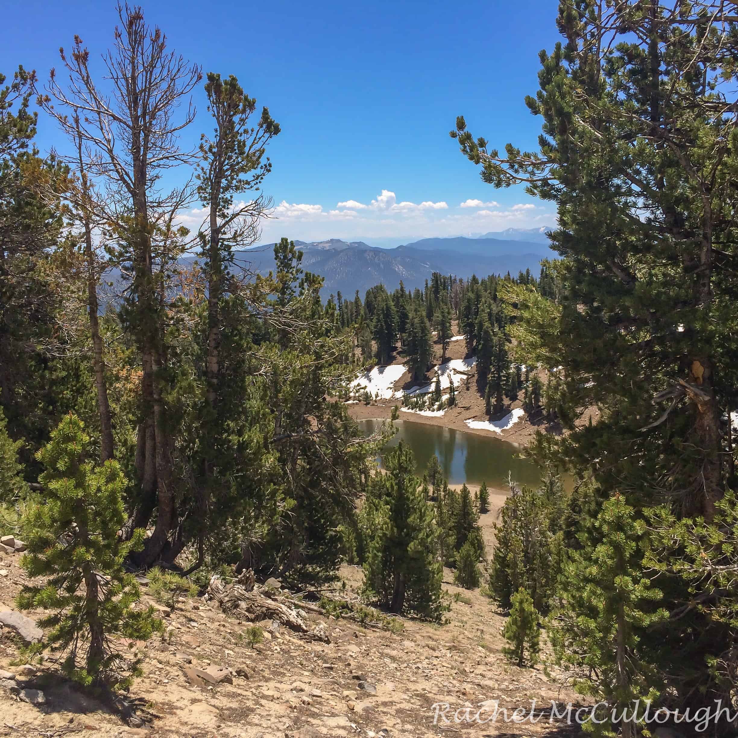
We finally reached Mud Lake, and while it wasn’t as disappointing as one might think, it might not be the destination most people have in mind after hiking 10+ miles. But it did have water and it wasn’t muddy at all! So, we grumbled a bit about carrying a total of 10 liters of water, but oh well.
At this point, we figured we must be getting close to the spot we’d left off last time. So, we commenced what seemed like the longest part of the hike, which consisted of about a mile, with more uphill than perhaps we had envisioned. I say envisioned because the topo clearly showed the uphill, we just didn’t quite internalize what we saw.
We finally reached a familiar spot and were able to remember where we sat to rest and a trail that could be seen in the distance. Somehow we still questioned ourselves a bit. We couldn’t come all this way and miss a few hundred foot section in the middle! So went just a little bit further until we spotted Ginny Lake. Now we were sure. Ginny Lake is a muddy lake. Strange that the clearest lake in the area is named Mud Lake and the muddy lake is named Ginny Lake. I didn’t take long to ponder that because we started to head back and I had my sights set on Rifle Peak.

Rifle Peak is not too far off the trail, but it’s a little steep! We found another hiker at the summit who snapped our photo. Confusion ensued when we told him where we came from and how we got there. And then counted out the miles for him!


We only spent a couple of minutes at the summit, wondering if the building clouds would produce any rain. It wasn’t in the forecast, but they did seem to be staying east.


We took our longest break of the hike right before we lost our most expansive lake view. It was hard to motivate to leave that spot, but after 10 minutes, it was go time.


The final miles somehow melted away. Good conversation definitely helps. We hit the road at about 5:45pm, ready for some dinner. Our evening plans entailed walking two miles to happy hour at a friends’, putting us at 25 miles for the day. We joked we should make a lap around the neighborhood and make it a full marathon. Oh well, another time!
Tahoe Mountain Sports Gear We Used:


Leave a comment